ארכיפלג Tuamotus בדרום האוקיינוס השקט
ניווט באטול הוא משימה מיוחד, שלא כמו שיוט חופים. עדיף ראיה בעין במקום מפות אלקטרוניות ומסתמך על מים צלולים, טרופיים ושמש גבוהה מעל הראש!
- העיניים שלך הן הכלי הטוב ביותר שלך.
- משקפי שמש פולארויד חיוניים.
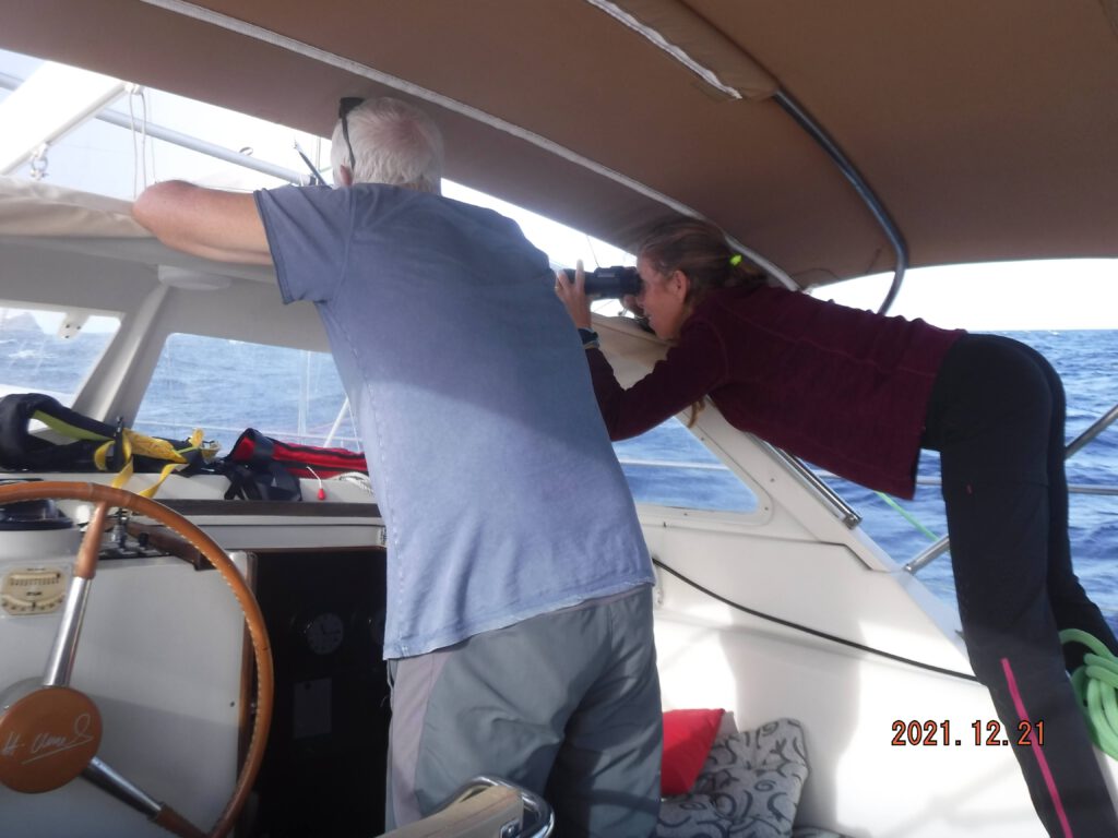
- העלה את אחד מהצוות גבוה ככל האפשר;
- חשוב לצאת במזג אויר טוב, ללא ערפל, גשם ,או ראות לקויה
- חשוב להגיע בזמן הנכון ביום כדי שהשמש תהיה מאחור וגבוה יחסית בשמיים
- לעולם אל תנסה לעבור במעבר צר ,רדוד (אנחנו עשינו את זה ,3 שעות של התקפת לב, לא להפליג כשהשמש נמוכה מידי או מקדימה.
- לאחר קצת תרגול, קל יותר לשפוט את
עומק לפי צבע האלמוגים:
- כחול כהה מסמן מים עמוקים.
- על פני חול, ככל שהצבע בהיר יותר, כך רדוד יותר
- ראשי אלמוגים נוטים להיות בעלי חום אופייני צבע וצורה מוגדרת.
- אצות ים הן בצבע וצפיפות שונה מאלמוגים או חול וצורתם פחות מוגדרת
חישוב שעת המעבר בatol ,שעת הSLACK
קשה לחזות במדויק את הזמן הנכון לsalck .צריך לקחת בחשבון כמה גורמים, שעה אחרי השפל בכניסה ושעה אחרי הגאות ביציאה, עוצמת הרוח,צורת הatol , כמה כניסות ויציאות יש ל ATOL , רוחב ואורך ועומק המעבר.
עגינה בתוך אטולים
לקח לנו זמן להבין איך עוגנים בתוך האטול,הבומים (שוניות אלמוגים) נמצאים בכל מקום ובעומק רדוד ,עגנו בגאות ב7 מטר ובשפל לאחר 66 שעות היינו על שונית בגובה 2 מטר. הרוח מסתובבת כל הזמן באטול וצריך לבדוק את המצב 360 מעלות, חזיתות עוברות ויכולות לגרום לשינוי פתאומי בכיוון הרוח ובעוצמתה
במצב זה, אם אלמוגים ראשים (‘בומי’) שוכבים בקרבת מקום, שרשרת העוגן עוטפת אותם ולא ניתן לשחרר אותה.
חשוב להמשיך לעקוב אחרי תחזית מזג אויר כל הזמן ולהכין תוכנית מילוט , חשוב לא לעגון במים יותר עמוקים מ10 מטר כדי שאם יש בעיה תוכלו לצלול לאורך השרשרת ולשחרר אותה מהבומי.
הכי קל ,בשעת עליית העוגן כשמישהו מהצוות במים, ומכוון את הסקיפר אשר על ההגה.
Atoll navigation is a special task, unlike coastal cruising. Eye sight is better than electronic maps and relies on clear, tropical water and sun high overhead!
Your eyes are your best tool.
Polaroid sunglasses are essential.
Raise one of the team as high as possible;
It is important to go out in good weather, without fog, rain, or poor visibility
It is important to arrive at the right time of day so that the sun is behind and relatively high in the sky
Never try to go through a narrow, shallow passage (we did it, 3 hours of a heart attack), don’t sail when the sun is too low or ahead.
After a little practice, it’s easier to judge the
Depth by coral color:
Dark blue indicates deep water.
On a sand surface, the lighter the color, the shallower it is
Coral heads tend to have a characteristic brown color and a defined shape.
Seaweeds are different in color and density than coral or sand and their shape is less defined
Calculation of the transit time in the atol, the SLACK time
It is difficult to accurately predict the right time to salck. You have to take into account several factors, one hour after the low tide at the entrance and one hour after the high tide at the exit, the strength of the wind, the shape of the atoll, how many entrances and exits the ATOL has, width and length and the depth of the passage.
Mooring in atolls
It took us a while to understand how to anchor inside the atoll, the booms (coral reefs) are everywhere and at a shallow depth, we anchored at high tide at 7 meters and at low tide after 66 hours we were on a reef at a height of 2 meters. The wind rotates all the time in the atoll and you need to check the situation 360 degrees, fronts pass and can cause a sudden change in the direction and strength of the wind
In this situation, if head corals (‘bumi’) lie nearby, the anchor chain wraps around them and cannot be released.
It is important to keep following the weather forecast all the time and prepare an escape plan, it is important not to anchor in water deeper than 10 meters so that if there is a problem you can dive along the chain and release it from the boom.
The easiest, at the time of raising the anchor when someone from the crew is in the water, directing the skipper who is at the wheel.
מפות באטולים
אין לסמוך על מפות אלקטרוניות ובטח לא נביוניקס בתוך האטולים, לכן יש לנקוט בזהירות ובתשומת לב הראויה בכל עת.
ההפלגה בין אלמוגים בפעם הראשונה יכולה להיות מורטת עצבים! חיבים להשתמש בכל אמצעי שיש לכם,הוrדת תמונות מgoogle EARTH, או CPMOPEN כל כלי זמין כדי לעזור לאשר את המיקום בפועל של היאכטה.
Maps in atolls
Electronic maps and certainly not Navionics inside the atolls are not to be trusted, therefore due care and attention must be exercised at all times.
Sailing among corals for the first time can be nerve wracking! You must use whatever means you have, downloading images from google earth, or CPMOPEN any tool available to help confirm the actual location of the yacht.
RARIOA
makemo

